CONTENTS
2....... Water Quality Monitoring
2.2.1 Monitoring Parameters and Frequency
2.2.3 Operational/ Analytical Procedures
2.3.1 Calibration of In-situ Instruments
2.3.2 Decontamination Procedures
2.3.3 Sampling Management and Supervision
2.3.4 Quality Control Measures for Sample Testing
2.4 Baseline Water Quality Monitoring Results
3....... Marine Mammal Monitoring
3.1.1 Vessel-based Line Transect Survey
3.1.2 Passive Acoustic Monitoring
3.2.1 Vessel-based Line Transect Survey
3.2.2 Passive Acoustic Monitoring
4....... Revisions on Updated EM&A Manual
Annexes
Annex A Baseline Water Quality Monitoring
Annex A1 Calibration Certificates
Annex A2 Monitoring Schedule
Annex A3 Baseline Water Quality Monitoring Results
Annex A4 Graphical Presentation of Baseline Water Quality Monitoring Results
Annex B Baseline Marine Mammal Monitoring
Annex B1 Monitoring Schedule
Annex B2 Vessel-based Line Transect Survey Effort Database
Annex B3 Finless Porpoise Sighting Database
Annex B4 PAM Deployment Database
List of Tables
Table 2.1 Location of Water Quality Monitoring Stations
Table 2.2 Water Quality Monitoring Parameters and Frequency
Table 2.3 Water Quality Monitoring Equipment
Table 2.4 Summary of Monitoring Results for DO, Turbidity and SS
Table 2.5 Summary of Monitoring Results for TRC
Table 2.6 Summary of EPD Routine Water Quality Monitoring Data
Table 2.7 Results of the Statistical Analyses
Table 2.8 Action and Limit Levels for Construction Phase Marine Water Monitoring
Table 2.9 Calculated Action and Limit Levels for Construction Phase Marine Water Monitoring
Table 2.10 Event and Action Plan for Water Quality Monitoring
Table 3.1 Monthly and Quarterly STG and ANI for Finless Porpoise
Table 3.2 Summary of PAM data for each Location
Table 3.3 Action and Limit Levels for Marine Mammal Monitoring
Table 3.4 Event and Action Plan for Marine Mammal Monitoring
List of Figures
Figure 1.1 Indicative Location of Key Project Components
Figure 1.2 Indicative Location of the Gas Receiving Station at Black Point Power Station
Figure 1.3 Indicative Location of the Gas Receiving Station at Lamma Power Station
Figure 2.1 Water Quality Monitoring Locations
Figure 3.1 Vessel-Based Marine Mammal Survey Location
Figure 3.2 Underwater PAM Survey Location
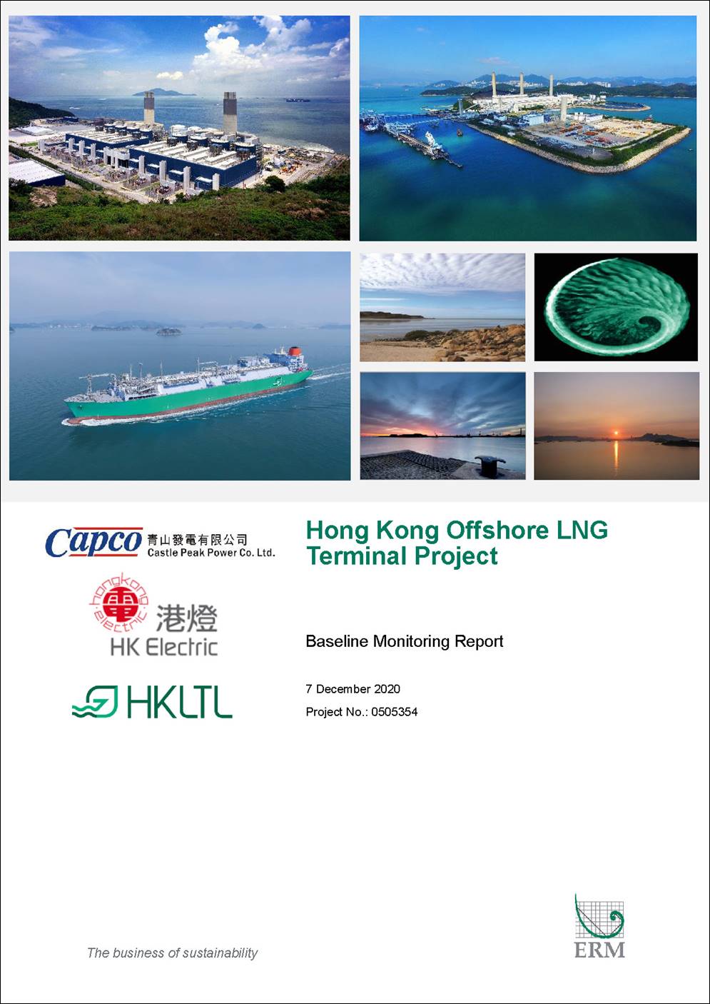
To support the increased use of natural gas in Hong Kong from 2020 onwards, Castle Peak Power Company Limited (CAPCO) and The Hongkong Electric Co., Ltd. (HK Electric) have identified that the development of an offshore liquefied natural gas (LNG) receiving terminal in Hong Kong using Floating Storage and Regasification Unit (FSRU) technology (‘the Project’) presents a viable additional gas supply option that will provide energy security through access to competitive gas supplies from world markets. The Project will involve the construction and operation of an offshore LNG import facility to be located in the southern waters of Hong Kong, a double berth jetty, and subsea pipelines that connect to the gas receiving stations (GRS) at the Black Point Power Station (BPPS) and the Lamma Power Station (LPS). In accordance with the Updated EM&A Manual of the Project, baseline water quality and marine mammal monitoring were undertaken for the Project prior to the commencement of the construction works.
Baseline water quality monitoring was conducted three times a week for four weeks during wet season (Aug – Sep 2019) and four weeks during dry season (Dec 2019 – Jan 2020) at 35 monitoring stations specified in the Updated EM&A Manual. Overall, no observable pollution source was recorded at the monitoring stations and no marine construction works were observed in the vicinity of all monitoring stations during the baseline monitoring period. The baseline monitoring results are thus considered representative of the ambient water quality levels. Action and Limit Levels for construction phase marine water quality monitoring were established for Dissolved Oxygen (DO), Turbidity and Suspended Solids (SS) based on the baseline monitoring results.
Baseline marine mammal monitoring was conducted for six months using vessel-based line transect surveys and passive acoustic monitoring (PAM). Vessel-based line transect surveys were conducted during June to November 2019, with a total of 36 line-transect surveys completed in Southwest Lantau (SWL), Southeast Lantau (SEL) and Lamma (LM) waters while PAM was conducted in the vicinity of the LNG Terminal site in September 2019 to March 2020. The distribution and encounter rate of Finless Porpoise in southern Lantau where a majority of Project construction works would take place were examined. Action and Limit Levels for construction phase marine mammal monitoring were established for Finless Porpoise based on the baseline monitoring results.
Upon agreement with EPD on this Baseline Monitoring Report, the Action and Limit Levels as proposed in this Report will be included in the next version of the Updated EM&A Manual.
To support the increased use of natural gas in Hong Kong from 2020 onwards, Castle Peak Power Company Limited (CAPCO) and The Hongkong Electric Co., Ltd. (HK Electric) have identified that the development of an offshore liquefied natural gas (LNG) receiving terminal in Hong Kong using Floating Storage and Regasification Unit (FSRU) technology (‘the Project’) presents a viable additional gas supply option that will provide energy security through access to competitive gas supplies from world markets. The Project will involve the construction and operation of an offshore LNG import facility to be located in the southern waters of Hong Kong, a double berth jetty, and subsea pipelines that connect to the gas receiving stations (GRS) at the Black Point Power Station (BPPS) and the Lamma Power Station (LPS).
The Environmental Impact Assessment (EIA) Report for the Project was submitted to the Environmental Protection Department (EPD) of the HKSAR Government in May 2018. The EIA Report (EIAO Register No. AEIAR-218/2018) was approved by EPD and the associated Environmental Permit (EP) (EP-558/2018) was issued in October 2018.
An application for Further Environmental Permits (FEP) were made on 24 December 2019 to demarcate the works between the different parties. The following FEPs were issued on 17 January 2020 and the EP under EP-558/2018 was surrendered on 5 March 2020:
§ the double berth jetty at LNG Terminal under the Hong Kong LNG Terminal Limited, joint venture between CAPCO and HK Electric (FEP-01/558/2018);
§ the subsea gas pipeline for the BPPS and the associated GRS in the BPPS under CAPCO (FEP-03/558/2018); and
§ the subsea gas pipeline for the LPS and the associated GRS in the LPS under HK Electric (FEP-02/558/2018).
This Baseline Monitoring Report is prepared in accordance with the requirements as set out in the Updated EM&A Manual of the Project and shall be applicable to fulfilling Condition 5.3 of all three FEPs.
The Project is comprised of the following key components:
§ An offshore LNG receiving terminal (LNG Terminal) that comprises of the Jetty and the FSRU Vessel, under FEP-01/558/2018;
§ Two subsea gas pipelines, namely:
o The BPPS Pipeline, connecting the LNG Terminal with the GRS at the BPPS, under FEP-03/558/2018; and
o The LPS Pipeline, connecting the LNG Terminal with the GRS at the LPS, under FEP-02/558/2018;
§ The GRS facilities, namely:
o The GRS located within the BPPS, under FEP-03/558/2018; and
o The GRS located within the LPS, under FEP-02/558/2018.
The location of these components is shown in Figures 1.1 to 1.3.
The remainder of the Baseline Monitoring Report is structured as follows:
§ Section 2 details the monitoring locations, monitoring methodology, QA/QC requirements, baseline monitoring results, proposed action and limit levels, and the event and action plan for water quality monitoring;
§ Section 3 details the monitoring locations, monitoring methodology, baseline monitoring results, proposed action and limit levels, and the event and action plan for marine mammal monitoring;
§ Section 4 summarises the revisions for the Updated EM&A Manual; and
§ Section 5 provides the conclusion of this baseline monitoring.
In accordance with the Updated EM&A Manual of the Project, baseline water quality monitoring was conducted three times per week for at least four weeks to establish the baseline conditions prior to the commencement of marine construction works for the Project and to demonstrate the suitability of the proposed control monitoring stations. Considering the seasonal variation in water quality, especially on dissolved oxygen, turbidity and suspended solids, baseline water quality monitoring was conducted for four weeks in the wet season (Aug – Sep 2019) and four weeks in the dry season (Dec 2019 – Jan 2020). The baseline conditions were established by measuring relevant water quality parameters at all designated monitoring stations for the Project, including control stations at mid-ebb and mid-flood tides. Further details of the baseline water quality monitoring under this Project are presented in the following sections.
Baseline water quality monitoring was conducted at 35 monitoring stations within five Water Control Zones (WCZs), namely Deep Bay WCZ, North Western WCZ, North Western Supplementary WCZ, Southern WCZ and Second Southern Supplementary WCZ, comprising 22 impact stations, seven ebb-tide control stations and six flood-tide control stations. The locations of the monitoring stations are presented in Figure 2.1. The coordinates and description of monitoring stations are summarised in Table 2.1.
Table 2.1 Location of Water Quality Monitoring Stations
|
Station |
Easting |
Northing |
Description |
|
|
Monitoring stations within Southern WCZ and Second Southern Supplementary WCZ |
||||
|
IM1 |
829453 |
806896 |
Impact Station for Coastline of South Lamma |
|
|
IM2 |
828235 |
810347 |
Impact Station for Coastline of North Lamma |
|
|
IM3 |
820683 |
805931 |
Impact Station for Coastline of South Cheung Chau |
|
|
IM4 |
816997 |
805153 |
Impact Station for Coastline of South Shek Kwu Chau |
|
|
IM5 |
814068 |
804100 |
Boundary of Proposed South Lantau Marine Park (MP) |
|
|
IM6 |
814073 |
802029 |
Boundary of Proposed South Lantau MP |
|
|
IM7 |
811652 |
802029 |
Boundary of Proposed South Lantau MP |
|
|
IM8 |
810833 |
801430 |
Boundary of Proposed South Lantau MP |
|
|
IM9 |
807101 |
801595 |
Boundary of Proposed South Lantau MP |
|
|
IM10 |
803145 |
806407 |
Boundary of Southwest Lantau MP |
|
|
E1 |
827317 |
811510 |
Control Station for Ebb Tide |
|
|
E2 |
813367 |
808213 |
Control Station for Ebb Tide |
|
|
E3 |
802686 |
804123 |
Control Station for Ebb Tide |
|
|
F1 |
827892 |
804243 |
Control Station for Flood Tide |
|
|
F2 |
822532 |
802161 |
Control Station for Flood Tide |
|
|
F3 |
815032 |
801161 |
Control Station for Flood Tide |
|
|
F4 |
809058 |
806567 |
Control Station for Flood Tide |
|
|
Monitoring stations within Deep Bay WCZ, North Western WCZ, North Western Supplementary WCZ |
||||
|
IM11A |
801914 |
806510 |
Boundary of Southwest Lantau MP |
|
|
IM12 |
801041 |
807024 |
Boundary of Southwest Lantau MP |
|
|
IM13 |
800386 |
810750 |
Boundary of Southwest Lantau MP |
|
|
IM14 |
801376 |
810750 |
Boundary of Southwest Lantau MP |
|
|
IM15 |
804820 |
821110 |
Boundary of Sha Chau and Lung Kwu Chau MP |
|
|
IM16A |
805039 |
824343 |
Coral Colonies at Pak Chau |
|
|
IM17 |
804865 |
827855 |
Boundary of Sha Chau and Lung Kwu Chau MP |
|
|
IM18 |
806220 |
827890 |
Boundary of Sha Chau and Lung Kwu Chau MP |
|
|
IM19 |
807274 |
829250 |
Impact Station for Coastline of Lung Kwu Tan |
|
|
IM20A |
809445 |
831728 |
Impact Station for Coastline of Deep Bay |
|
|
IM21A |
808879 |
830900 |
Coral Colony at Artificial Seawall at BPPS |
|
|
IM22A |
808703 |
830717 |
Coral Colony at Artificial Seawall at BPPS |
|
|
E4 |
801571 |
811923 |
Control Station for Ebb Tide |
|
|
E5 |
804634 |
822606 |
Control Station for Ebb Tide |
|
|
E6 |
805418 |
832113 |
Control Station for Ebb Tide |
|
|
E7A |
808313 |
833524 |
Control Station for Ebb Tide |
|
|
F5 |
805185 |
816591 |
Control Station for Flood Tide |
|
|
F6 |
808812 |
824266 |
Control Station for Flood Tide |
|
|
Note: Total Residual Chlorine (TRC) was measured only at monitoring stations IM6, F3 and E2 during baseline monitoring for the purpose of comparing against the operation phase monitoring. |
||||
The parameters that have been selected for measurement in situ and in the laboratory are those that were either determined in the EIA to be those with the highest potential to be affected by the construction works or are a standard check on water quality conditions. Table 2.2 summarises the monitoring parameters, monitoring period and frequencies of the water quality monitoring. The measurement of monitoring parameters followed the standard methods and detection limit requirements as stated in Table 5.2 of the Updated EM&A Manual.
Table 2.2 Water Quality Monitoring Parameters and Frequency
|
Monitoring Station |
Parameters |
Depth |
Frequency and Replication |
|
Impact Stations IM1, IM2, IM3, IM4, IM5, IM6, IM7, IM8, IM9, IM10, IM11A, IM12, IM13, IM14, IM15, IM16A, IM17, IM18, IM19, IM20A, IM21A, IM22A
Control Stations Ebb tide - E1, E2, E3, E4, E5, E6, E7A
Flood tide - F1, F2, F3, F4, F5, F6 |
· Dissolved Oxygen (DO) (mg/L) · Dissolved Oxygen Saturation (DOS) (%) · Temperature (°C) · pH · Turbidity (NTU) · Salinity (ppt) · Water depth (m) · Suspended Solid (SS) (mg/L) · Total Residual Chlorine (TRC) (mg/L) * |
· Three water depths: 1 m below sea surface, mid-depth and 1 m above seabed.
· If the water depth is less than 3 m, mid-depth sampling only.
· If water depth less than 6 m, mid-depth would be omitted. |
· Baseline monitoring: three days per week, at mid-flood and mid-ebb tides, for at least four weeks prior to the commencement of construction work.
· Two replicates of in-situ measurements and water samples at each depth at each station. |
|
* Note: TRC was measured only at monitoring stations IM6, F3 and E2 during baseline monitoring for the purpose of comparing against the operation phase monitoring. |
|||
In addition to the water quality parameters, other relevant data were also measured and recorded in Water Quality Monitoring Logs, including the location of the monitoring stations, water depth, time, weather conditions, sea conditions, tidal state, current direction and velocity, special phenomena and work activities undertaken around the monitoring and works area that may influence the monitoring results.
Table 2.3 summarises the equipment used in the baseline monitoring works. All of the monitoring equipment complied with the requirements as set out in the Updated EM&A Manual.
Table 2.3 Water Quality Monitoring Equipment
|
Equipment |
Brand and Model |
|
Water Sampling Equipment |
Rosette multibottle array water sampler with Niskin 2L samplers Wildlife Supply Company, 2.2L water sampler |
|
Positioning Device |
C-Nav GcGPS Positioning System Furuno, GPS Navigator GP-170 Garmin, eTrex series |
|
Water Depth Gauge |
Knudsen 320M Lowrance, Mark 5x Garmin, Striker series |
|
Equipment for Dissolved Oxygen, Temperature, Turbidity, pH and Salinity measurements |
Wet season (Aug-Sep 19) YSI 6920 and YSI 6820, S/N: MPP 15, MPP 30, MPP 37, MPP 46 YSI ProDSS, S/N: 15M100005, 17E100747, 17H105557, 18A104824 YSI 6920, S/N: 0001C6A7, 00019CB2
Dry season (Dec 19 – Jan 20) YSI 6920 and YSI 6820, S/N: MPP 15, MPP 37, MPP44 YSI ProDSS, S/N: 16H104234, 17E100747, 17H105557 YSI 6920, S/N: 0001C6A7, 00019CB2
|
|
Equipment for Current Velocity and Direction measurements |
Workhorse Sentinel ADCP, Self-contained 1,200 and 600 kHz Sontek, S/N: 5161, 5489 |
|
Equipment for Total Residual Chlorine (TRC) measurements |
Hanna Instruments, HI761 |
At each monitoring station, two consecutive measurements of DO level, DO Saturation, Temperature, Turbidity, Salinity and pH were taken at each sampling depth. Where the difference in the value between the first and second readings of each set was more than 25% of the value of the first reading, the reading was discarded and further readings were taken. Two water samples were collected for laboratory analysis of SS content. Following sample collection, water samples were stored in high density polythene bottles (1L) with no preservatives added, packed in ice (cooled to 4°C without being frozen) and kept in dark during both on-site temporary storage and transfer to the testing laboratory. The samples were delivered to the laboratory as soon as possible and the laboratory determination works started within 24 hours after collection of the water samples.
The testing of SS for all monitoring stations was conducted by a Hong Kong Laboratory Accreditation Scheme (HOKLAS) accredited laboratory, ALS Technichem (HK) Pty Ltd. (HOKLAS Registration No. 066). Comprehensive quality assurance and control procedures were in place in order to ensure quality and consistency in results.
In situ monitoring equipment for the measurement of temperature, dissolved oxygen, turbidity, pH and salinity was checked, calibrated and certified by a laboratory accredited under HOKLAS before use. Copies of the calibration certificates for the measuring equipment for DO, Temperature, Turbidity, pH and Salinity are attached in Annex A1. The test kit for TRC was checked against the calibration check set provided by the manufacturer before commencement of monitoring. The in situ monitoring equipment for the measurement of temperature, dissolved oxygen, turbidity, pH and salinity was subsequently re-calibrated every three months throughout the baseline water quality monitoring. Responses of sensors and electrodes were checked with certified standard solutions before each use. Wet bulb calibrations for dissolved oxygen meter were carried out before commencement of monitoring and after completion of all measurements each day.
On-site calibration of field equipment followed the “Guide to On-Site Test Methods for the Analysis of Waters”, BS 1427: 2009. Sufficient stocks of spare parts were maintained for replacements when necessary. Backup monitoring equipment was also made available to ensure monitoring could proceed uninterrupted even when equipment is under maintenance, calibration etc.
Water sampling equipment used during the course of the baseline monitoring was decontaminated by manual washing and rinsed with clean seawater/distilled water after each sampling event. All disposable equipment was discarded after sampling.
All sampling bottles were labelled with the sample ID (including the indication of sampling station and tidal stage e.g. IM1_ME_S_R1), laboratory number and sampling date. All water samples were handled under chain of custody protocols and relinquished to the laboratory representatives at locations specified by the laboratory.
The samples testing were performed by ALS Technichem (HK) Pty Ltd. The following quality control programme was performed by the laboratory for every batch of 20 samples:
§ One method blank; and
§ One set of quality control (QC) samples (including method QC and sample duplicate).
Baseline water quality monitoring was conducted three times per week at 35 stations during wet season (4 weeks from 14 August to 17 September 2019) ([1]) and dry season (4 weeks from 26 December 2019 to 22 January 2020). The detailed monitoring schedule is shown in Annex A2. The monitoring results with weather and sea conditions at each monitoring day are shown in Annex A3. Graphical presentation of water quality monitoring results is given in Annex A4. Measurement of TRC was conducted in dry season at monitoring stations IM6, F3 and E2. Most of the TRC measurements were lower than the detection limit (i.e. <0.001 mg/L). The water quality monitoring results for DO, Turbidity and SS and those for TRC are summarised in Table 2.4 and Table 2.5, respectively below.
Table 2.4 Summary of Monitoring Results for DO, Turbidity and SS
|
Station |
DO (Surface & Middle) (mg/L) |
DO (Bottom) (mg/L) |
Turbidity (NTU) |
SS (mg/L) |
||||||||||||
|
Ebb Tide |
Flood Tide |
Ebb Tide |
Flood Tide |
Ebb Tide |
Flood Tide |
Ebb Tide |
Flood Tide |
|||||||||
|
Wet |
Dry |
Wet |
Dry |
Wet |
Dry |
Wet |
Dry |
Wet |
Dry |
Wet |
Dry |
Wet |
Dry |
Wet |
Dry |
|
|
E1 |
6.3±2.1 |
7.1±0.5 |
5.1±1.0 |
6.9±0.7 |
4.2±1.0 |
7.1±0.5 |
4.4±0.7 |
6.9±0.5 |
6.6±5.9 |
5.6±2.7 |
7.2±6.8 |
4.7±2.9 |
9.7±8.8 |
9.5±4.1 |
9.1±8.0 |
8.8±4.5 |
|
E2 |
7.4±2.7 |
7.7±0.6 |
7.7±2.2 |
7.5±0.7 |
3.1±1.4 |
7.5±0.4 |
3.9±1.5 |
7.3±0.2 |
6.8±7.4 |
4.5±2.2 |
7.0±8.0 |
4.9±2.4 |
10.5±9.8 |
7.6±2.8 |
10.2±13.7 |
8.4±4.2 |
|
E3 |
5.6±1.7 |
7.8±0.4 |
5.6±1.6 |
7.8±0.4 |
3.8±1.0 |
7.7±0.3 |
4.0±1.0 |
7.7±0.3 |
9.3±13.6 |
5.9±8.2 |
11.0±10.8 |
6.5±7.8 |
12.0±17.9 |
7.7±4.2 |
15.0±15.3 |
10.3±9.0 |
|
E4 |
5.3±1.7 |
7.6±0.4 |
6.0±2.2 |
7.7±0.5 |
3.9±1.1 |
7.6±0.4 |
4.2±0.9 |
7.6±0.4 |
25.6±42.7 |
12.0±13.0 |
13.3±16.8 |
10.4±5.9 |
18.4±18.5 |
19.5±23.5 |
13.6±16.7 |
16.0±11.4 |
|
E5 |
6.1±1.2 |
7.7±0.4 |
5.6±1.1 |
7.7±0.7 |
5.0±0.9 |
7.5±0.3 |
5.2±0.8 |
7.5±0.6 |
5.7±4.7 |
13.4±13.9 |
10.2±7.8 |
13.2±7.0 |
8.3±6.8 |
19.2±21.7 |
12.2±11.4 |
22.4±15.8 |
|
E6 |
5.5±1.0 |
7.2±0.3 |
4.9±1.1 |
7.2±0.3 |
4.8±0.6 |
7.2±0.3 |
4.1±0.5 |
7.1±0.3 |
5.5±3.2 |
6.4±4.1 |
15.9±13.5 |
7.2±4.7 |
8.3±5.8 |
8.7±5.4 |
20.5±20.8 |
9.5±6.9 |
|
E7A |
5.7±0.8 |
7.1±0.3 |
5.5±1.0 |
7.2±0.3 |
4.9±0.7 |
7.1±0.3 |
4.7±0.6 |
7.2±0.3 |
5.3±3.3 |
4.8±2.6 |
11.0±9.5 |
7.1±4.5 |
7.2±5.0 |
6.9±4.7 |
13.8±16.4 |
10.3±10.6 |
|
F1 |
7.0±3.5 |
7.7±0.3 |
6.0±3.3 |
7.6±0.4 |
3.5±1.4 |
7.6±0.2 |
3.2±1.1 |
7.5±0.2 |
5.5±6.0 |
2.9±2.0 |
7.2±12.2 |
2.9±2.4 |
7.8±6.5 |
6.1±5.4 |
10.4±17.2 |
5.9±4.6 |
|
F2 |
7.1±3.2 |
7.8±0.2 |
6.7±3.3 |
7.7±0.3 |
3.5±1.1 |
7.6±0.1 |
3.5±1.2 |
7.5±0.2 |
4.7±4.4 |
2.1±1.7 |
5.3±4.5 |
2.5±1.9 |
7.0±5.8 |
4.9±2.9 |
7.1±5.9 |
5.6±3.1 |
|
F3 |
6.8±2.9 |
7.8±0.3 |
6.6±3.2 |
7.9±0.4 |
3.5±1.0 |
7.6±0.1 |
3.4±1.2 |
7.6±0.2 |
5.2±5.4 |
2.1±1.2 |
6.6±7.3 |
3.0±1.9 |
9.1±10.3 |
5.4±2.3 |
9.4±9.9 |
6.0±3.4 |
|
F4 |
6.3±2.6 |
7.9±0.7 |
6.6±2.5 |
7.8±0.7 |
3.5±1.2 |
7.8±0.6 |
3.2±1.1 |
7.6±0.5 |
5.8±4.4 |
4.9±3.6 |
8.3±8.0 |
7.6±6.3 |
7.8±5.5 |
8.7±5.0 |
11.3±12.0 |
12.3±8.8 |
|
F5 |
6.0±1.4 |
7.7±0.4 |
6.0±1.8 |
7.8±0.5 |
4.8±0.9 |
7.6±0.3 |
4.9±1.1 |
7.6±0.4 |
5.7±4.9 |
12.1±12.2 |
10.5±8.4 |
9.5±6.5 |
7.9±6.2 |
19.7±21.1 |
10.0±9.0 |
14.6±10.0 |
|
F6 |
5.2±1.3 |
7.3±0.3 |
5.5±1.4 |
7.2±0.3 |
3.9±0.8 |
7.2±0.5 |
4.3±0.6 |
7.0±0.4 |
12.8±14.9 |
6.4±5.0 |
12.6±15.9 |
9.3±9.1 |
16.1±19.3 |
9.9±6.8 |
16.0±22.4 |
12.9±14.0 |
|
IM1 |
7.4±2.9 |
7.6±0.3 |
6.8±3.0 |
7.6±0.5 |
4.2±1.2 |
7.6±0.3 |
3.9±1.1 |
7.5±0.3 |
4.2±3.9 |
3.9±1.8 |
6.0±6.2 |
3.4±1.3 |
6.7±5.8 |
7.2±2.7 |
10.0±9.0 |
6.8±2.4 |
|
IM2 |
6.9±2.0 |
7.3±0.6 |
5.6±1.7 |
7.1±0.7 |
3.7±1.4 |
7.3±0.5 |
4.0±1.3 |
7.0±0.4 |
6.4±7.3 |
4.4±2.9 |
6.3±4.7 |
3.6±1.7 |
9.7±11.6 |
7.7±3.7 |
9.1±5.3 |
7.4±3.6 |
|
IM3 |
6.0±3.3 |
7.8±0.6 |
6.9±2.8 |
7.7±0.8 |
3.0±1.3 |
7.5±0.3 |
2.9±1.4 |
7.4±0.3 |
6.7±6.0 |
6.1±6.0 |
5.7±4.6 |
4.6±3.9 |
9.9±7.7 |
9.4±8.2 |
9.5±6.6 |
9.5±6.7 |
|
IM4 |
6.2±2.8 |
7.8±0.6 |
6.9±2.8 |
7.8±0.8 |
3.1±1.2 |
7.6±0.4 |
3.1±1.3 |
7.4±0.3 |
8.5±10.0 |
4.9±3.5 |
6.6±6.2 |
4.6±3.9 |
13.7±15.7 |
8.2±5.3 |
10.0±8.3 |
8.8±6.2 |
|
IM5 |
6.7±2.8 |
7.8±0.4 |
6.6±2.9 |
7.8±0.7 |
3.4±1.0 |
7.7±0.3 |
3.4±1.3 |
7.5±0.3 |
6.6±7.3 |
4.6±4.4 |
6.6±8.7 |
3.9±3.2 |
10.1±9.6 |
8.4±7.5 |
9.6±9.3 |
6.9±2.8 |
|
IM6 |
6.8±2.9 |
7.8±0.3 |
7.1±3.3 |
7.9±0.6 |
3.5±1.1 |
7.7±0.2 |
3.6±1.2 |
7.6±0.2 |
5.4±5.7 |
2.4±1.6 |
6.5±6.5 |
3.2±2.2 |
8.6±7.9 |
6.1±2.7 |
8.3±7.3 |
5.9±3.0 |
|
IM7 |
6.6±2.1 |
7.9±0.4 |
6.7±2.4 |
8.0±0.5 |
4.2±1.2 |
7.9±0.4 |
3.9±1.0 |
7.7±0.2 |
4.2±3.9 |
3.1±2.7 |
5.3±4.6 |
2.6±1.8 |
7.1±5.7 |
5.0±3.6 |
7.9±6.9 |
6.8±6.1 |
|
IM8 |
6.6±2.7 |
7.9±0.3 |
6.6±2.9 |
8.0±0.4 |
3.8±1.1 |
7.8±0.2 |
3.7±1.1 |
7.8±0.3 |
6.0±6.3 |
3.0±3.3 |
13.2±22.1 |
3.3±2.7 |
8.8±7.5 |
5.7±4.4 |
10.1±10.8 |
6.4±4.3 |
|
IM9 |
6.7±2.1 |
7.8±0.5 |
6.7±2.7 |
7.9±0.5 |
4.3±0.9 |
7.8±0.4 |
4.0±0.9 |
7.8±0.3 |
5.5±4.8 |
4.0±3.1 |
8.8±9.5 |
5.9±6.0 |
8.5±6.4 |
6.4±4.4 |
14.0±15.8 |
7.4±5.0 |
|
IM10 |
4.9±2.0 |
7.8±0.5 |
5.2±1.9 |
7.8±0.5 |
3.8±1.0 |
7.7±0.4 |
3.8±1.0 |
7.7±0.4 |
25.3±22.3 |
13.7±15.3 |
18.0±18.5 |
10.9±10.2 |
31.5±28.7 |
21.5±20.0 |
23.4±22.1 |
21.9±27.2 |
|
IM11A |
6.4±2.0 |
7.7±0.5 |
7.0±2.5 |
7.7±0.4 |
5.6±1.7 |
7.7±0.4 |
6.4±2.0 |
7.7±0.3 |
35.6±25.0 |
18.4±17.4 |
20.7±21.5 |
23.9±25.1 |
46.2±38.2 |
28.8±22.3 |
19.2±16.8 |
36.0±23.1 |
|
IM12 |
5.8±2.2 |
7.7±0.5 |
6.1±2.3 |
7.7±0.4 |
3.9±1.0 |
7.7±0.5 |
4.2±1.2 |
7.6±0.4 |
50.4±77.6 |
13.2±12.8 |
20.5±27.0 |
15.0±11.9 |
30.5±31.8 |
26.3±29.4 |
25.8±29.1 |
21.5±14.0 |
|
IM13 |
5.7±2.0 |
7.7±0.4 |
5.3±2.1 |
7.7±0.4 |
3.9±1.1 |
7.6±0.4 |
3.8±1.1 |
7.6±0.3 |
23.6±46.6 |
9.9±11.9 |
12.7±9.0 |
11.6±8.9 |
18.2±20.1 |
12.5±10.7 |
16.7±12.9 |
15.4±10.0 |
|
IM14 |
6.1±2.0 |
7.6±0.5 |
6.3±2.4 |
7.6±0.4 |
4.0±1.0 |
7.6±0.3 |
4.2±0.9 |
7.6±0.3 |
29.2±50.3 |
14.7±15.0 |
11.7±11.0 |
11.3±6.2 |
20.1±27.1 |
25.4±32.3 |
15.6±15.8 |
17.2±9.1 |
|
IM15 |
5.6±0.9 |
7.7±0.5 |
6.0±2.0 |
7.7±0.7 |
4.8±0.8 |
7.6±0.4 |
5.4±1.4 |
7.5±0.5 |
7.7±9.0 |
10.5±8.2 |
8.1±4.4 |
14.2±11.2 |
9.7±12.0 |
16.9±17.6 |
11.3±6.8 |
24.8±22.4 |
|
IM16A |
5.8±1.2 |
7.6±0.6 |
5.4±1.2 |
7.6±0.7 |
4.5±0.7 |
7.6±0.6 |
4.9±0.6 |
7.4±0.5 |
7.6±6.9 |
13.8±12.5 |
11.5±7.5 |
10.7±10.2 |
10.9±13.6 |
20.4±20.5 |
15.2±10.8 |
16.1±14.7 |
|
IM17 |
6.0±1.0 |
7.6±0.6 |
5.5±1.4 |
7.4±0.4 |
5.1±0.7 |
7.5±0.6 |
5.0±0.8 |
7.3±0.4 |
7.3±4.5 |
11.3±8.3 |
15.8±16.6 |
8.9±4.1 |
8.6±4.9 |
16.7±15.7 |
21.9±29.9 |
11.1±6.3 |
|
IM18 |
5.3±1.2 |
7.2±0.4 |
4.7±1.1 |
7.1±0.4 |
3.8±0.5 |
6.9±0.3 |
3.6±0.7 |
6.9±0.6 |
10.5±13.4 |
5.8±4.5 |
23.4±29.8 |
6.0±4.4 |
13.2±20.3 |
7.1±4.0 |
21.4±20.6 |
7.0±3.8 |
|
IM19 |
5.0±1.0 |
7.2±0.3 |
5.0±1.2 |
7.1±0.3 |
3.9±0.6 |
7.0±0.3 |
3.8±0.7 |
7.0±0.3 |
14.1±16.7 |
3.8±2.3 |
19.2±24.2 |
5.9±5.1 |
17.0±17.5 |
5.8±2.5 |
21.3±28.4 |
6.5±4.4 |
|
IM20A |
5.7±0.8 |
7.2±0.3 |
5.5±0.8 |
7.3±0.3 |
4.9±0.7 |
7.2±0.3 |
4.7±0.7 |
7.2±0.3 |
8.2±7.7 |
6.7±3.3 |
11.9±7.1 |
7.9±4.9 |
11.1±9.9 |
10.2±4.8 |
16.0±9.1 |
11.8±6.9 |
|
IM21A |
5.3±0.9 |
7.1±0.3 |
5.4±0.8 |
7.3±0.2 |
4.8±0.8 |
7.1±0.3 |
4.7±0.6 |
7.4±0.2 |
17.3±15.1 |
9.4±7.0 |
21.0±9.5 |
7.9±5.7 |
19.5±16.4 |
15.7±15.9 |
26.1±12.3 |
14.1±9.4 |
|
IM22A |
5.3±0.7 |
7.1±0.2 |
5.3±0.8 |
7.2±0.3 |
5.1±0.6 |
7.1±0.3 |
4.5±0.5 |
7.2±0.3 |
17.6±11.7 |
7.1±3.5 |
18.2±12.9 |
6.6±4.8 |
20.7±13.7 |
12.0±5.8 |
24.6±20.2 |
10.6±7.2 |
|
Notes: (1) Averaged value ± standard deviation and the range of values (in bracket) are presented in each cell. (2) Outliers are excluded in the dataset for the calculation of the water quality monitoring results.
|
||||||||||||||||
Table 2.5 Summary of Monitoring Results for TRC
|
Station |
TRC (mg/L) |
|
|
|
Ebb Tide |
Flood Tide |
|
|
|
E2 |
0.011±0.014 (<0.001 - 0.059) |
0.006±0.005 |
|
|
F3 |
0.006±0.005 |
0.013±0.013 |
|
|
IM6 |
0.005±0.003 |
0.008±0.008 |
|
|
Note: 1) Averaged value ± standard deviation and the range of values (in bracket) are presented in each cell |
|||
The baseline water quality monitoring results showed that the levels of DO, Turbidity and SS varied across monitoring stations (both control and impact stations) and over time. It is noticed that extraordinarily high levels of Turbidity and SS were occasionally recorded during the monitoring. Repeat in-situ measurement was conducted during the baseline monitoring to confirm findings. Upon checking the field records, no marine construction works were observed in the vicinity of all monitoring stations during the baseline monitoring period. No other external factors (e.g. surface runoff from nearby landmass, adverse weather) were identified that might affect water quality at the monitoring stations during the baseline monitoring period. In view of the extraordinarily high levels of Turbidity and SS recorded, further analysis was conducted to identify outliers for the dataset obtained during the baseline monitoring. The analysis has been conducted with reference to the selected stations of the Deep Bay WCZ, North Western WCZ, Western Buffer WCZ and Southern WCZ from the EPD routine water quality monitoring data collected in the past 15 years from 2004 to 2018. The summary of the levels of Turbidity and SS collected from the EPD routine water quality monitoring data is presented in Table 2.6.
Table 2.6 Summary of EPD Routine Water Quality Monitoring Data
|
Water Control Zone |
Range (Min – Max) of Turbidity (NTU)
|
Range (Min – Max) of SS (mg/L)
|
|
Deep Bay WCZ (DM3, DM4, DM5) |
1.0 – 197.8 |
1.3 - 110.0 |
|
North Western WCZ (NM3, NM5, NM6, NM8) |
0.6 - 868.4 |
<0.5 – 150.0 |
|
Western Buffer and Southern WCZ (WM1, SM5, SM6, SM7, SM12, SM13, SM17, SM18, SM20) |
0.1 - 114.3 |
<0.5 – 180.0 |
|
Note: a. The EPD water quality monitoring stations for each WCZ has been selected based on the proximity with the Project with reference to the approved EIA Report.
|
||
From the past 15 years (2004-2018) EPD routine water quality monitoring data as shown in Table 2.6, it is understood that the levels of Turbidity and SS also varied over time, which represent natural fluctuations in marine water quality for each of the WCZs. As such, the Turbidity / SS data obtained during the baseline monitoring period having values higher than the maximum Turbidity / SS of the corresponding WCZs from EPD routine water quality monitoring data are considered as outliers and they are excluded in the data analysis thereafter.
With reference to Section 12.2 of the Updated EM&A Manual, analysis was also conducted between control and impact stations to determine the representativeness of the control stations for the Project during impact monitoring. As Turbidity and SS are evaluated against the Action and Limit levels using control stations, they are further analysed statistically. As the water quality monitoring stations are located within different WCZs, statistical analyses were conducted to determine the 95% confidence interval of control and impact stations in 8 groups based on the work locations with reference to Table 5.3 of the Updated EM&A Manual. The results of the statistical analyses are presented in Table 2.7.
Table 2.7 Results of the Statistical Analyses
|
Group
|
Description
|
95% Confidence Interval for Turbidity (NTU) |
95% Confidence Interval for SS (mg/L) |
||
|
Control |
Impact Stations |
Control |
Impact Stations |
||
|
1 |
During construction at the pipeline shore approach at LPS (LPS KP18.2-17.4), West Lamma Channel (LPS KP14.5-17.4) Impact Stations: IM1, IM2 Control Stations: E1 (Ebb), F1 (Flood) |
4.75 - 6.41 |
4.42 - 5.14 |
7.68 - 10.05 |
7.56 - 8.60 |
|
2 |
During construction at the Double Berth Jetty to West Lamma Channel (LPS KP0.0-14.5) Impact Stations: IM3, IM4, IM5, IM6 Control Stations: E2 (Ebb), F2 (Flood), F3 (Flood) |
4.29 - 5.25 |
5.10 - 5.77 |
7.08 - 8.35 |
8.46 - 9.38 |
|
3 |
During construction at the Jetty Approach (BPPS KP0.0 – 5.0), South of Soko Islands (BPPS KP5.0 – 8.9), Southwest of Soko Islands (BPPS KP8.9 - 12.1) Impact Stations: IM6, IM7, IM8, IM9 Control Stations: E3 (Ebb), F3 (Flood) |
5.16 - 7.25 |
4.71 - 5.59 |
7.55 - 10.03 |
7.27 - 8.12 |
|
4 |
During construction at the Adamasta Channel (BPPS KP12.1 - 15.6), Southwest Lantau (BPPS KP15.6 - 21.3) Impact Stations: IM10, IM11A, IM12, IM13, IM14 Control Stations: E4 (Ebb), F4 (Flood) |
10.60 - 16.12 |
17.60 - 20.77 |
13.36 - 17.31 |
21.75 - 24.36 |
|
5 |
During construction at the West of Tai O to West of HKIA (BPPS KP21.3 – 31.5) Impact Stations: IM15 Control Stations: E5 (Ebb), F5 (Flood) |
8.56 - 11.00 |
8.91 - 11.14 |
11.30 - 14.89 |
13.30 - 17.46 |
|
6 |
During construction at the West of HKIA to Lung Kwu Chau (BPPS KP31.5 – 37.5) Impact Stations: IM15, IM16A, IM17 Control Stations: E6 (Ebb), F5 (Flood) |
7.03 - 8.55 |
9.89 - 11.29 |
9.27 - 11.28 |
14.03 - 16.47 |
|
7 |
During construction at the Lung Kwu Chau to Urmston Anchorage (BPPS 37.5 - 41.1), Urmston Road (BPPS KP41.1 – 42.9) Impact Stations: IM17, IM18, IM19 Control Stations: E6 (Ebb), F6 (Flood), E5 (Flood) |
8.50 - 10.40 |
9.92 - 12.13 |
11.86 - 14.79 |
11.72 - 14.15 |
|
8 |
During construction at the West of BPPS (BPPS KP42.9 - 44.9), Pipeline shore approach at BPPS (BPPS KP44.9 - 45.0) Impact Stations: IM19, IM20A, IM21A, IM22A Control Stations: E7a (Ebb), F6 (Flood) |
7.19 - 9.84 |
10.54 - 12.18 |
9.54 - 13.33 |
13.91 - 15.89 |
|
Note: a. The cells are bolded if there is no overlapping of 95% confidence intervals of Turbidity / SS between control and impact stations within a group. |
|||||
The results of the statistical analysis showed that the control stations for some of the groups (i.e. Groups 1, 2 (Turbidity only), 3, 5 and 7) did not differ from the impact stations significantly (i.e. overlapping of 95% confidence intervals of Turbidity / SS between control and impact stations within a group) and thus the control stations within these groups are representative for the purpose of impact monitoring. For the groups showing significant differences (i.e. no overlapping of 95% confidence intervals of Turbidity / SS between control and impact stations within a group) between control and impact stations (i.e. Groups 2 (SS only), 4, 6 and 8), all the results showed that impact stations had higher levels of Turbidity / SS than the corresponding control stations. This indicates that if the control stations within these groups were used in the impact monitoring, they could be more conservative to demonstrate if there are any unacceptable impacts from the Project. Thus, the control stations within these groups could be considered for the purpose of impact monitoring.
Overall, the baseline monitoring results for both impact and control stations are considered representative of the ambient water quality of the Project area during both wet and dry seasons for determination of action and limit levels.
The water quality monitoring results indicated there were natural fluctuations in the marine environment and extraordinarily high values of Turbidity and SS occur occasionally throughout the monitoring over wet and dry seasons. Outliers for Turbidity and SS have been identified as discussed in Section 2.4 and they are excluded in the determination of Action and Limit Levels. Taking into account seasonal variation of water quality, water quality monitoring was evaluated against Action and Limit Levels using data from all seasons to determine water quality compliance. In view of the variations across monitoring stations, it is proposed to establish eight sets of Action and Limit Levels based on the eight groups of work locations with reference to Table 5.3 of the Updated EM&A Manual for the construction phase marine water monitoring. Action and Limit Levels of key assessment parameters for baseline water quality monitoring including DO, Turbidity and SS are determined in accordance with requirements set out in the Updated EM&A Manual which are summarised in Table 2.8.
Table 2.8 Action and Limit Levels for Construction Phase Marine Water Monitoring
|
Parameter |
Action Level |
Limit Level |
|
DO in mg L-1 a |
Surface and Middle 5th%-ile of baseline data for surface and middle layers
Bottom 5th%-ile of baseline data for bottom layer
|
Surface and Middle 4 mg L-1 or 1%ile of baseline for surface and middle layers
Bottom 2 mg L-1 or 1%ile of baseline for bottom layer
|
|
Turbidity in NTU (Depth-averaged b) c |
95th%-ile of baseline data, and 120% of the relevant control station's turbidity at the same tide of the same day
|
99th%-ile of baseline data, and 130% of the relevant control station's turbidity at the same tide of the same day |
|
SS in mg L-1 (Depth-averaged b) c |
95th%-ile of baseline data, and 120% of the relevant control station's SS at the same tide of the same day
|
99th%-ile of baseline data, and 130% of the relevant control station's SS at the same tide of the same day |
|
Notes: a. For DO, non-compliance of the water quality limits occurs when monitoring result is lower than the limits. b. “Depth-averaged” is calculated by taking the arithmetic means of reading of all three depths. c. For SS and Turbidity, non-compliance of the water quality limits occurs when monitoring result is higher than the limits. |
||
The calculated Action and Limit levels for Construction Phase Marine Water Monitoring based on the work locations are shown in Table 2.9. The Action and Limit levels for first-year Operation Phase Marine Water Monitoring will be determined for submission to EPD for approval before the commencement of operation of the monitoring programme, with reference to the latest water quality data from EPD Marine Water Quality Monitoring Station SM17.
Table 2.9 Calculated Action and Limit Levels for Construction Phase Marine Water Monitoring
|
Parameter |
Action Level |
Limit Level |
||||||
|
Group 1 – During construction at the pipeline shore approach at LPS (LPS KP18.2-17.4), West Lamma Channel (LPS KP14.5-17.4) |
||||||||
|
DO in mg L-1 a |
Surface and Middle 4.2 mg L-1
Bottom 2.4 mg L-1
|
Surface and Middle 2.9 mg L-1
Bottom 1.6 mg L-1
|
||||||
|
Turbidity in NTU (Depth-averaged b) c |
14.4 NTU, and 120% of the relevant control station's turbidity at the same tide of the same day
|
19.9 NTU, and 130% of the relevant control station's turbidity at the same tide of the same day |
||||||
|
SS in mg L-1 (Depth-averaged b) c |
20.8 mg L-1, and 120% of the relevant control station's SS at the same tide of the same day
|
29.6 mg L-1, and 130% of the relevant control station's SS at the same tide of the same day |
||||||
|
Group 2 - During construction at the Double Berth Jetty to West Lamma Channel (KP0.0-14.5) |
||||||||
|
DO in mg L-1 a |
Surface and Middle 3.4 mg L-1
Bottom 1.8 mg L-1
|
Surface and Middle 2.4 mg L-1
Bottom 1.4 mg L-1
|
||||||
|
Turbidity in NTU (Depth-averaged b) c |
17.1 NTU, and 120% of the relevant control station's turbidity at the same tide of the same day
|
26.8 NTU, and 130% of the relevant control station's turbidity at the same tide of the same day |
||||||
|
SS in mg L-1 (Depth-averaged b) c |
25.7 mg L-1, and 120% of the relevant control station's SS at the same tide of the same day
|
37.1 mg L-1, and 130% of the relevant control station's SS at the same tide of the same day |
||||||
|
Group 3 – During construction at the Jetty Approach (BPPS KP0.0 – 5.0), South of Soko Islands (BPPS KP5.0 – 8.9), Southwest of Soko Islands (BPPS KP8.9 - 12.1) |
||||||||
|
DO in mg L-1 a |
Surface and Middle 4.1 mg L-1
Bottom 2.7 mg L-1
|
Surface and Middle 3.0 mg L-1
Bottom 2.0 mg L-1
|
||||||
|
Turbidity in NTU (Depth-averaged b) c |
17.0 NTU, and 120% of the relevant control station's turbidity at the same tide of the same day
|
30.9 NTU, and 130% of the relevant control station's turbidity at the same tide of the same day |
||||||
|
SS in mg L-1 (Depth-averaged b) c |
22.3 mg L-1, and 120% of the relevant control station's SS at the same tide of the same day
|
36.9 mg L-1, and 130% of the relevant control station's SS at the same tide of the same day |
||||||
|
Group 4 - During construction at the Adamasta Channel (BPPS KP12.1 - 15.6), Southwest Lantau (BPPS KP15.6 - 21.3) |
||||||||
|
DO in mg L-1 a |
Surface and Middle 3.4 mg L-1
Bottom 2.8 mg L-1
|
Surface and Middle 2.5 mg L-1
Bottom 2.0 mg L-1
|
||||||
|
Turbidity in NTU (Depth-averaged b) c |
63.1 NTU, and 120% of the relevant control station's turbidity at the same tide of the same day
|
165.7 NTU, and 130% of the relevant control station's turbidity at the same tide of the same day |
||||||
|
SS in mg L-1 (Depth-averaged b) c |
75.4 mg L-1, and 120% of the relevant control station's SS at the same tide of the same day
|
121.8 mg L-1, and 130% of the relevant control station's SS at the same tide of the same day |
||||||
|
Group 5 – During construction at the West of Tai O to West of HKIA (BPPS KP21.3 – 31.5) |
||||||||
|
DO in mg L-1 a |
Surface and Middle 4.6 mg L-1
Bottom 4.0 mg L-1
|
Surface and Middle 4.0 mg L-1
Bottom 2.0 mg L-1
|
||||||
|
Turbidity in NTU (Depth-averaged b) c |
31.9 NTU, and 120% of the relevant control station's turbidity at the same tide of the same day
|
46.6 NTU, and 130% of the relevant control station's turbidity at the same tide of the same day |
||||||
|
SS in mg L-1 (Depth-averaged b) c |
64.9 mg L-1, and 120% of the relevant control station's SS at the same tide of the same day
|
72.5 mg L-1, and 130% of the relevant control station's SS at the same tide of the same day |
||||||
|
Group 6 - During construction at the West of HKIA to Lung Kwu Chau (BPPS KP31.5 – 37.5) |
||||||||
|
DO in mg L-1 a |
Surface and Middle 4.4 mg L-1
Bottom 3.9 mg L-1
|
Surface and Middle 3.9 mg L-1
Bottom 2.0 mg L-1
|
||||||
|
Turbidity in NTU (Depth-averaged b) c |
30.7 NTU, and 120% of the relevant control station's turbidity at the same tide of the same day
|
47.0 NTU, and 130% of the relevant control station's turbidity at the same tide of the same day |
||||||
|
SS in mg L-1 (Depth-averaged b) c |
49.2 mg L-1, and 120% of the relevant control station's SS at the same tide of the same day
|
74.0 mg L-1, and 130% of the relevant control station's SS at the same tide of the same day
|
||||||
|
Group 7 – During construction at the Lung Kwu Chau to Urmston Anchorage (BPPS 37.5 - 41.1), Urmston Road (BPPS KP41.1 – 42.9) |
||||||||
|
DO in mg L-1 a |
Surface and Middle 3.8 mg L-1
Bottom 3.1 mg L-1
|
Surface and Middle 3.4 mg L-1
Bottom 2.0 mg L-1
|
||||||
|
Turbidity in NTU (Depth-averaged b) c |
34.5 NTU, and 120% of the relevant control station's turbidity at the same tide of the same day
|
79.2 NTU, and 130% of the relevant control station's turbidity at the same tide of the same day |
||||||
|
SS in mg L-1 (Depth-averaged b) c |
37.8 mg L-1, and 120% of the relevant control station's SS at the same tide of the same day
|
98.2 mg L-1, and 130% of the relevant control station's SS at the same tide of the same day |
||||||
|
Group 8 - During construction at the West of BPPS (BPPS KP42.9 - 44.9), Pipeline shore approach at BPPS (BPPS KP44.9 - 45.0) |
||||||||
|
DO in mg L-1 a |
Surface and Middle 4.3 mg L-1
Bottom 3.6 mg L-1
|
Surface and Middle 3.4 mg L-1
Bottom 2.0 mg L-1
|
||||||
|
Turbidity in NTU (Depth-averaged b) c |
34.3 NTU, and 120% of the relevant control station's turbidity at the same tide of the same day
|
58.5 NTU, and 130% of the relevant control station's turbidity at the same tide of the same day |
||||||
|
SS in mg L-1 (Depth-averaged b) c |
42.4 mg L-1, and 120% of the relevant control station's SS at the same tide of the same day
|
78.2 mg L-1, and 130% of the relevant control station's SS at the same tide of the same day |
||||||
|
Notes: a. For DO, non-compliance of the water quality limits occurs when monitoring result is lower than the limits. b. “Depth-averaged” is calculated by taking the arithmetic means of reading of all three depths. c. For Turbidity and SS, non-compliance of the water quality limits occurs when monitoring result is higher than the limits. |
||||||||
Should non-compliance of the criteria for water
quality occur, action in accordance with the Event and Action Plan presented in
Table 2.10 below shall be carried out and review works would be
conducted.
Table 2.10 Event and Action Plan for Water Quality Monitoring
|
Event |
Action |
|||
|
ET |
IEC |
Contractor(s) |
Project Proponents |
|
|
Action Level being exceeded by one sampling day |
1. Repeat in-situ measurement to confirm findings; 2. Check monitoring data, plant, equipment and Contractor(s)’s working methods; 3. Identify source(s) of impact and record in notification of exceedance; 4. Inform IEC, Contractor(s) and Project Proponents.
|
1. Check monitoring data submitted by ET and Contractor(s)’s working methods. |
1. Confirm receipt of notification of exceedance in writing; 2. Check plant and equipment and rectify unacceptable practice. |
1. Confirm receipt of notification of exceedance in writing. |
|
Action Level being exceeded by two or more consecutive sampling days |
1. Repeat in-situ measurement to confirm findings; 2. Check monitoring data, plant, equipment and Contractor(s)’s working methods; 3. Identify source(s) of impact and record in notification of exceedance; 4. Inform IEC, Contractor(s) and Project Proponents; 5. Discuss with IEC and Contractor(s) on additional mitigation measures and ensure that they are implemented.
|
1. Check monitoring data submitted by ET and Contractor(s)’s working methods; 2. Discuss with ET and Contractor(s) on additional mitigation measures and advise Project Proponents accordingly; 3. Assess the effectiveness of the implemented mitigation measures.
|
1. Confirm receipt of notification of exceedance in writing; 2. Check plant and equipment and rectify unacceptable practice; 3. Consider changes of working methods; 4. Discuss with ET and IEC on additional mitigation measures and propose them to Project Proponents within 3 working days; 5. Implement the agreed mitigation measures. |
1. Confirm receipt of notification of exceedance in writing; 2. Discuss with the IEC on the proposed additional mitigation measures and agree on the mitigation measures to be implemented; 3. Ensure additional mitigation measures are properly implemented. |
|
Limit Level being exceeded by one sampling day |
1. Repeat in situ measurement to confirm findings; 2. Check monitoring data, plant, equipment and Contractor(s)’s working methods; 3. Identify source(s) of impact and record in notification of exceedance; 4. Inform IEC, Contractor(s), Project Proponents and EPD; 5. Discuss with IEC and Contractor(s) on additional mitigation measures and ensure that they are implemented.
|
1. Check monitoring data submitted by ET and Contractor(s)’s working methods; 2. Discuss with ET and Contractor(s) on additional mitigation measures and advise Project Proponents accordingly; 3. Assess the effectiveness of the implemented mitigation measures.
|
1. Confirm receipt of notification of exceedance in writing; 2. Check plant and equipment and rectify unacceptable practice; 3. Critically review the need to change working methods; 4. Discuss with ET and IEC on additional mitigation measures and propose them to Project Proponents within 3 working days; 5. Implement the agreed mitigation measures. |
1. Confirm receipt of notification of exceedance in writing; 2. Discuss with the IEC on the proposed additional mitigation measures and agree on the mitigation measures to be implemented; 3. Ensure additional mitigation measures are properly implemented; 4. Request Contractor(s) to critically review the working methods.
|
|
Limit Level being exceeded by two or more consecutive sampling days |
1. Repeat in situ measurement to confirm findings; 2. Check monitoring data, plant, equipment and Contractor(s)’s working methods; 3. Identify source(s) of impact and record in notification of exceedance; 4. Inform IEC, Contractor(s), Project Proponents and EPD; 5. Discuss with IEC and Contractor(s) on additional mitigation measures and ensure that they are implemented.
|
1. Check monitoring data submitted by ET and Contractor(s)’s working methods; 2. Discuss with ET and Contractor(s) on additional mitigation measures and advise Project Proponents accordingly; 3. Assess the effectiveness of the implemented mitigation measures. |
1. Confirm receipt of notification of exceedance in writing; 2. Check plant and equipment and rectify unacceptable practice; 3. Critically review the need to change working methods; 4. Discuss with ET and IEC on additional mitigation measures and propose them to Project Proponents within 3 working days; 5. Implement the agreed mitigation measures; 6. As directed by Project Proponents, slow down or stop all or part of the marine construction works until no exceedance of Limit Level. |
1. Confirm receipt of notification of exceedance in writing; 2. Discuss with the IEC on the proposed additional mitigation measures and agree on the mitigation measures to be implemented; 3. Ensure additional mitigation measures are properly implemented; 4. Request Contractor(s) to critically review the working methods; 5. Consider and instruct, if necessary, the Contractor(s) to slow down or to stop all or part of the marine construction works until no exceedance of Limit Level.
|
In order to determine the efficacy of the recommended mitigation measures and provide verification of impact prediction/ evaluation of results, marine mammal monitoring was recommended. Baseline monitoring was conducted using vessel-based line transect survey and passive acoustic monitoring (PAM) method according to the Updated EM&A Manual.
Vessel-based marine mammal survey by means of systematic line-transect boat survey was undertaken to examine the distribution and encounter rate of Finless Porpoise (FP) in southern Lantau where a majority of Project construction works would take place. Survey transects covering three survey areas for line-transect boat surveys, namely Southwest Lantau (SWL), Southeast Lantau (SEL) and Lamma (LM), are presented in Figure 3.1.
The transect boat survey was conducted from a 15m inboard vessels (with an open upper deck above the pilothouse, providing a mostly unobstructed 180° view of the area ahead of the vessel), weather permitting (Beaufort 0-5, no heavy rain, and visibility > 1,200m). The marine mammal observer (MMO) team conducted searches and observations from the flying bridge area, 4-5m eye height above the water surface. In order to ensure the quality of the data and allow consistency with the long-term AFCD database, and take consideration of the sea conditions of the monitoring site, a team of three qualified and trained MMOs made up the survey team.
As the vessel transits the transect lines at a relatively constant speed of 13-15km hr-1, the primary MMO searched for marine mammals continuously through 7 X 50 marine binoculars. A second MMO searched with unaided eye and filled out data sheets. Both MMOs searched ahead of the vessel, between 270° and 90° (in relation to the bow, which is defined as 0°). MMOs rotated positions approximately every 30 minutes. An additional MMO was on the boat, who rotated into position to give observers a rest after each hour of search effort to minimise fatigue.
Effort data collected during on-effort monitoring periods included time and position for the start and end of search effort, vessel speed, sea state (Beaufort scale), visibility, and distance travelled in each series (a continuous period of search effort). When marine mammals were sighted, the survey team would end the survey effort and fill out a sighting sheet. The vessel would divert from its course to approach the marine mammal group for group size estimation, behavioural observations, and collection of identification photos. The sighting sheet included information on initial sighting angle and distance, position of initial sighting, sea state, group size and composition, and behaviour, such as response to the survey vessel and associations with vessels. Position, distance travelled, and vessel speed were obtained from a hand-held Global Positioning System (GPS) unit. The perpendicular distance (PSD) of the marine mammal group to the transect line was later calculated from the initial sighting distance and angle.
All records of marine mammal sightings were collated, compiled and integrated with Geographic Information System (GIS). Positions of sightings together with group sizes, activities and calf occurrence were plotted on figures for illustration of spatial and temporal patterns of porpoise distribution, if any. The method for line transect analysis of porpoise encounter rate followed the established approach for AFCD long-term marine mammal monitoring ([2]). It should be noted that as FP are cryptic and difficult to identify as unique individuals with no useful natural markings, the potential of double counting could not be eliminated and hence rendering any abundance or density estimation confounded with serious violation of assumption under the line-transect survey method; therefore such analysis was not proposed to be completed for FP, which is the same approach adopted for the AFCD long-term marine mammal monitoring.
Vessel-based line transect marine mammal surveys were conducted for six months between June and November 2019 with each transect line surveyed twice per month during baseline monitoring. Given the Action and Limit Levels to be established from the six months marine mammal surveys are to detect unacceptable/ unforeseen changes in FP distribution as construction work progresses, the following analyses were conducted for FP only.
The line-transect survey data was integrated with a Geographic Information System (GIS) to visualize and interpret different spatial and temporal patterns of FP distribution using their sighting positions collected from vessel surveys. Location data of porpoise groups were plotted on map layers of Hong Kong using a desktop GIS (ArcView© 3.1) to examine their distribution patterns in detail. The dataset was also stratified into different subsets to examine distribution patterns of porpoise groups with different categories of group sizes, activities, fishing boat associations and young calves.
Since the line-transect survey effort was uneven among different survey areas and across different months of the study period, the encounter rates of FP in terms of number of on-effort sightings per 100 km of survey effort, and total number of porpoise sighted on-effort per 100 km of survey effort) were calculated in each survey area in relation to the amount of survey effort conducted. The encounter rate could be used as an indicator to determine areas of importance to porpoises within the survey areas.
Only survey data collected under Beaufort 2 or below condition would be used for encounter rate analysis of FP ([3]). Formula for encounter rate is provided below:
Encounter Rate of Number of Porpoise Sightings
(STG)
![]()
Encounter Rate of Number of Porpoises (ANI)
![]()
Underwater PAM surveys were conducted to monitor porpoise usage of southern Lantau waters over 24 hours under all weather conditions. Specific C-POD (Cetacean-Porpoise Detector) devices were used to record vocalizations of echolocating toothed whales and dolphins, in particular FP by detecting the trains of echolocation sounds they produced. C-PODs were deployed at five locations on the seabed within and in the vicinity of the LNG Terminal site, including three monitoring locations near the LNG terminal site (i.e. Locations 2-4), one monitoring location at east of Tai A Chau (i.e. Location 1) and one monitoring location at southeast of Shek Kwu Chau (i.e. Location 5) (Figure 3.2). During each deployment, the C-POD unit serial numbers as well as the time and date of deployments were recorded. Information including the GPS positions and water depth at each of the deployment locations were also obtained. The records downloaded from the C-PODs were examined to identify vocalisation of FP. Analysis was undertaken to obtain information on FP, including:
§ Number of clicks: calculated per hour to detect diel patterns, and per day to determine activity level at a site;
§ Detection positive minutes (DPM): indicates the total amount of minutes where at least one click train was detected within a one minute time period, to measure the duration the FP spent in an area;
§ Duration of click trains: provides an indication of the average density of FP at a site; and
§ Encounter rates: represents the number of porpoise echolocation click train (>5 clicks) encounters per hour of acoustic measurement with the C-POD.
Any spatial or temporal trends (especially the 24-hour activity patterns) in changes of the above parameters were determined.
For detailed data analyses, the raw click data on the C-POD was first converted by the CPOD.exe software to “CP1” files. The click data was then processed using the KERNO classifier to identify click trains and their likely sources, and to reject weak boat sonar. The classified click trains were recorded in a “CP3” file.
The integrity of data record was first checked, and the period of adequate deployment and correct operation were identified. Visual validation was then performed to assess the overall rate of false positive detection positive minutes (DPM) as identified by the KERNO classifier. This validation method was based on the characteristics of clicks, multi-path clusters, and trains. Additional criteria based on the characteristics of the ambient noise regime could also be used, particularly in relation to boat sonar and sediment transport noise, which could generate a large number of ultrasonic “clicks”.
Notably, the level of false positives is not some consistent fraction of true positives, but is determined by the prevalence of the sources that are liable to be misclassified as dolphin clicks, such as boat sonar and sediment transport noise. Moreover, it should be recognized that the cause of a substantial proportion of the “false positive porpoises” was actually true porpoises, but were rejected simply because they were not distinctive enough to meet the stringency of these criteria.
After the visual validations, the DPMs could then be assessed as the parameter for porpoise occurrences at each deployment location. The DPM was chosen to calculate the total number of minutes where at least one click train was detected within a one-minute period, in order to measure the amount of time porpoises spend in an area.
Using DPM could eliminate the possibility of counting individual click trains produced by more than one porpoise, as the number of animals detected is unknown. The DPM is also useful for detecting diel and seasonal patterns of porpoise occurrences in order to determine the level of habitat utilization by both species at the various deployment locations.
During the six months of baseline monitoring surveys (i.e. June to November 2019), a total of 36 line-transect surveys were conducted among the three survey areas in SWL, SEL and LM. The detailed monitoring schedule is shown in Annex B1. Details of these survey effort data are presented in Annex B2.
A total of 2,597.64 km of survey effort was collected from the line-transect vessel surveys, which included 841.38 km in SWL, 819.08 km in SEL and 937.18 km in LM (Annex B2). The total survey effort conducted on primary and secondary lines among these three survey areas were 2,155.25 km and 442.39 km respectively. No other major activities (e.g. marine construction works) that might affect the results were recorded during the surveys. 61.9% of the total survey effort was conducted in condition of Beaufort Sea State 2 or below with good visibility, and such data can be used for the encounter rate analysis of FP.
For the six-month baseline monitoring period, a total of 21 groups of 39 FPs were sighted among the three survey areas and all of them were sighted during on-effort search (Annex B3). Among these FP sightings, a total of 18 groups of 35 FPs were sighted at Beaufort 2 or below (Annex B3), which can be utilized for encounter rate analysis.
Throughout the baseline monitoring period, the FPs were regularly sighted in the three survey areas of SWL, SEL and LM (Figure 3.3). Porpoise sightings were generally found to the southwest and southeast of Tai A Chau, to the east of Siu A Chau, and in the offshore waters between Cheung Chau and Lamma Island. On the contrary, porpoises rarely occurred at the western portion of SWL waters, the inshore waters to the south of Lantau Island (except a sighting made near Shui Hau Peninsula), as well as around Shek Kwu Chau and Cheung Chau.
Notably, only one porpoise sighting was made near the proposed jetty location of the Project. Furthermore, a few porpoise sightings were located near the proposed BPPS Pipeline, mainly to the southwest of Tai A Chau, while they also occurred southward to the eastern section (i.e. to the southwest of Lamma Island) of the LPS Pipeline.
The group sizes of FP occurred during the baseline monitoring period ranged from singletons to six animals, with an overall mean of 1.9 ± 1.35. The majority of porpoise groups were very small, with 81.0% of porpoise groups composed of 1-2 animals, while all except one group had less than five animals per group (Annex B3).
The porpoise sighting distributions with different group sizes is shown in Figure 3.4. The small groups of 1-2 porpoises largely resembled their overall distribution for the baseline monitoring period. On the other hand, the three medium-sized groups with 3-4 porpoises per group were found to the east of Soko Islands and to the southwest of Lamma Island. The only larger group with six porpoises was sighted near Shui Hau Peninsula.
The monthly and running quarterly STG and ANI for the combined survey areas from SWL, SEL and LM during the monitoring period are summarised in Table 3.1. The combined encounter rates of FP from all the survey areas (i.e. SWL, SEL and LM) during the six-month baseline monitoring period was 1.12 sightings per 100 km of survey effort. The monthly variations in combined porpoise encounter rates for the combined survey areas from SWL, SEL and LM during the baseline monitoring period indicated that porpoise occurrences peaked in September.
Table 3.1 Monthly and Quarterly STG and ANI for Finless Porpoise
|
Survey Period |
On-effort (km) |
No. of Sighting |
No. of Porpoise |
STG |
ANI |
Running STG |
Running ANI |
|
Jun 2019 |
314.88 |
3 |
7 |
0.95 |
2.22 |
- |
- |
|
Jul 2019 |
217.92 |
1 |
1 |
0.46 |
0.46 |
- |
- |
|
Aug 2019 |
337.92 |
3 |
8 |
0.89 |
2.37 |
0.80 |
1.84 |
|
Sep 2019 |
235.26 |
5 |
11 |
2.13 |
4.68 |
1.14 |
2.53 |
|
Oct 2019 |
208.51 |
2 |
3 |
0.96 |
1.44 |
1.28 |
2.81 |
|
Nov 2019 |
294.05 |
4 |
5 |
1.36 |
1.70 |
1.49 |
2.58 |
|
Jun – Nov 2019 |
1608.54 |
18 |
35 |
1.12 |
2.18 |
- |
- |
|
Notes: 1. Only data collected at Beaufort 2 or below were included for encounter rate analysis. 2. Running STG and Running ANI were calculated by combining three consecutive survey months data (e.g. running STG/ANI for Aug 2019 were calculated by combining the data in Jun – Aug 2019) |
|||||||
C-POD units were deployed at five locations (see Figure 3.2 for the locations) during the six-month monitoring period from 27 / 28 September 2019 to 31 March / 1 April 2020. All units from the five deployment locations were successfully recovered and refurbished for data download. The summaries of deployment data are presented in Table 3.2 below, with detection statistics of FP included in Annex B4.
Table 3.2 Summary of PAM data for each Location
|
Location |
Description |
|
Location 1 (East of Tai A Chau) |
The C-POD units were deployed for 185.9 days during the period of 27 September 2019 to 31 March 2020. Porpoise activity was recorded on all monitoring days (100%), with mean porpoise DPM per day to be 130.6.
|
|
Location 2 (FSRU-W) |
The C-POD units were deployed for 185.8 days during the period of 27 September 2019 to 31 March 2020. Porpoise activity was recorded on all monitoring days (100%), with mean porpoise DPM per day to be 207.1.
|
|
Location 3 (FSRU-E) |
The C-POD units were deployed for 185.1 days during the period of 28 September 2019 to 31 March 2020. Porpoise activity was recorded on all monitoring days (100%), with mean porpoise DPM per day to be 210.3.
|
|
Location 4 (FSRU-N) |
The C-POD units were deployed for 185.9 days during the period of 28 September 2019 to 1 April 2020. Porpoise activity was recorded on all monitoring days (100%), with mean porpoise DPM per day to be 241.5.
|
|
Location 5 (Shek Kwu Chau) |
The C-POD units were deployed for 185.8 days during the period of 28 September 2019 to 1 April 2020. Porpoise activity was recorded on most monitoring days (95.7%), with mean porpoise DPM per day to be 76.2.
|
Visual validation was used to assess the overall rate of false positive porpoise DPM as identified by the KERNO classifier. Such false positives were found to be 0-2% (with 95% confidence level) across the monitoring locations (Annex B4). Inspection of the sampled porpoise DPM found that the majority of false positives were most likely due to misclassified sediment transport noise.
Notably, the minute click limit can be exceeded in very noisy environments, meaning that no further clicks will be detected until the start of the next minutes. However, no time was lost at all five monitoring locations. Moreover, boat sonar was detected throughout the five monitoring locations, and this was generally around 50 kHz.
Variations in porpoise activity per day were observed at all five locations over the six-month monitoring period. Higher levels of porpoise activity were generally found between February and March 2020 for all the five locations (Figure 3.5). Among the five locations, the highest number of porpoise DPM was recorded at Location 4 (FSRU-N) while Locations 1 - 3 had larger variations of DPM across the monitoring period. In contrast, Location 5 (Shek Kwu Chau) recorded the least porpoise activity amongst the five locations with very low number of porpoise DPM recorded between late September and December 2019 (Figure 3.5).
FP activity in different hours of the day at the five locations is examined and comparison was made on the diel patterns among the five locations by each month from October 2019 to March 2020 and over the six-month monitoring period (Figures 3.6-3.7). Diel patterns were more distinguishable in February and March 2020 for all the five locations. All five sites generally showed a decline in porpoise activity from late morning to the middle of the day to some extent. Similar diel patterns were observed in Locations 2 - 4 (i.e. locations near the LNG terminal site). The diel pattern at Location 1 (East of Tai A Chau) was more distinguishable with higher porpoise activities during night-time. The diel pattern at Location 5 (Southeast of Shek Kwu Chau) was less distinguishable and the total DPM recorded throughout the six-month baseline monitoring period were lower than other locations.
According to the EIA, it is predicted that marine mammals would avoid the vicinity of the works areas during construction period and would return to the areas upon cessation of the disturbance. Consequently, there may be a decline of FP usage of some waters of the Southeast Lantau survey area where the LNG Terminal is located, while the animals are expected to move to the broader southern Lantau waters including the Southwest Lantau and Lamma survey areas and continue to use the broader areas to a similar degree.
To detect unacceptable/ unforeseen changes in FP distribution as construction work progresses, the Action Level and Limit Level for marine mammal monitoring are established using encounter rate calculated from the six-month baseline vessel-based line transect surveys from the three survey areas as a whole in accordance with the Updated EM&A Manual. The combined baseline encounter rate will be used to compare with the encounter rate obtained during monthly construction phase monitoring calculated from last three month’s monitoring data, i.e. running quarterly value. This approach would allow natural seasonal fluctuations in FP encounter rate to be accounted for, and allow data to be reviewed every month such as appropriate remedial actions could be taken timely if the threshold values are triggered. The action and limit levels are derived as stated in Table 3.3.
Table 3.3 Action and Limit Levels for Marine Mammal Monitoring
|
Monitoring Area |
Action Level |
Limit Level |
|
Criteria for establishing Action and Limit Levels |
||
|
SWL, SEL and LM as a whole |
Running quarterly STG & ANI < combined encounter rates from the six-month baseline monitoring data
|
Two consecutive running quarterly STG & ANI < combined encounter rates from the six-month baseline monitoring data |
|
Derived Values from the data obtained during the 6-month baseline vessel-based marine mammal surveys |
||
|
SWL, SEL and LM as a whole |
Running quarterly STG < 1.12 & ANI < 2.18 |
Two consecutive running quarterly STG < 1.12 & ANI < 2.18 |
|
Note: Action / Limit Levels will be triggered if both STG and ANI fall below the criteria.
|
||
Should non-compliance of the criteria for marine mammal monitoring occur, action in accordance with the Event and Action Plan presented in Table 3.4 below shall be carried out and review works would be conducted.
Table 3.4 Event and Action Plan for Marine Mammal Monitoring
|
Event |
Action |
|||
|
ET |
IEC |
Contractor(s) |
Project Proponents |
|
|
Action Level exceeded |
1. Check monitoring data and repeat data analysis to confirm findings; 2. Review available AFCD data and relevant EM&A data to check if the exceedance is due to natural variation or works related; 3. Identify potential source(s) of impact; 4. Inform the IEC, Project Proponents and Contractor; 5. Increase site inspection and audit frequency to ensure all the marine mammal protective and/or precautionary measures are properly implemented.
|
1. Check monitoring data and analysis and investigation by ET; 2. Conduct additional site inspection and audit with ET to ensure all the marine mammal protective and/or precautionary measures are properly implemented and advise Project Proponents the audit results and findings accordingly.
|
1. Inform the Project Proponents and confirm notification of the non-compliance in writing; 2. Conduct site inspection and audit with the ETL and IEC; 3. Ensure all the marine mammal protective and/or precautionary measures are properly implemented. |
1. Discuss the need for increased site inspection and audit frequency proposed by ET with IEC and the Contractor; 2. Check the audit results and findings from ET and IEC. |
|
Limit Level exceeded |
1. Check monitoring data and repeat data analysis to confirm findings; 2. Review available AFCD data and relevant EM&A data to check if the exceedance is due to natural variation or works related; 3. Identify potential source(s) of impact; 4. Inform the IEC, Project Proponents and Contractor; 5. Increase site inspection and audit frequency to ensure all the marine mammal protective and/or precautionary measures are properly implemented; 6. Review previous occurrence of non-compliance events to investigate if there is a longer term trend that needs attention; 7. ET to discuss and confirm with Project Proponents, IEC and Contractor on the need for further mitigation measures (e.g. consider controlling and, if necessary suspending marine works associated with the suspected source of impact). |
1. Check monitoring data and analysis and investigation by ET; 2. Conduct additional site inspection and audit with ET to ensure all the marine mammal protective and/or precautionary measures are properly implemented and advise Project Proponents the audit results and findings accordingly 3. Discuss and confirm further mitigation measures with Project Proponents, ET and Contractor; 4. Supervise / audit the implementation of further mitigation measures and advise Project Proponents the results and findings accordingly. |
1. Inform the Project Proponents and confirm notification of the non-compliance in writing; 2. Conduct site inspection and audit with the ETL and IEC; 3. Ensure all the marine mammal protective and/or precautionary measures are properly implemented; 4. Discuss and confirm further mitigation measures with the ETL, IEC and Project Proponents; 5. Carry out further measures when advised by ET and agreed by Project Proponents and IEC.
|
1. Discuss the need for increased site inspection and audit frequency proposed by ET with IEC and the Contractor; 2. Check the audit results and findings from ET and IEC; 3. Discuss and confirm further mitigation measures with the ET, IEC and Contractor; 4. Supervise the implementation of further mitigation measures. |
Upon agreement with EPD on this Baseline Monitoring Report, revisions for the Action and Limit Levels as proposed in this Report will be updated in the Updated EM&A Manual.
In accordance with the Updated EM&A Manual of the Project, baseline water quality and marine mammal monitoring were undertaken prior to commencement of the construction works of the Project.
Baseline water quality monitoring was conducted three times a week for four weeks during wet season (Aug – Sep 2019) and four weeks during dry season (Dec 2019 – Jan 2020) at 35 monitoring stations. Overall, no observable pollution source was recorded at the monitoring stations and no marine construction works were observed in the vicinity of all monitoring stations during the baseline monitoring period. The baseline monitoring results are thus considered representative of the ambient water quality levels. Action and Limit Levels for construction phase marine water quality monitoring were established for DO, SS and Turbidity based on the baseline monitoring results.
Baseline marine mammal monitoring was conducted for six months using vessel-based line transect surveys and PAM. A total of 36 vessel-based line-transect surveys were conducted during June to November 2019 in Southwest Lantau, Southeast Lantau and Lamma waters while PAM was conducted in the vicinity of the LNG Terminal site in September 2019 to March 2020. The distribution and encounter rate of FP at South Lantau waters were examined. Action and Limit Levels for construction phase marine mammal monitoring were established for FP based on the baseline monitoring results.
Upon agreement with EPD on this Baseline Monitoring Report, revisions for the Action and Limit Levels as proposed in this Report will be updated in the Updated EM&A Manual.
([1]) Some of the monitoring results obtained on 14, 16 and 19 August 2019 were discarded as they were sampled outside the planned tidal periods. Re-sampling at these monitoring stations was conducted on 14 and 17 September 2019. The planned monitoring on 2 September 2019 was postponed due to adverse weather.